Go if
You want roomy riverfront sites like B32 and easy access to Pinnacle Mountain State Park amenities.
 4.50996 reviews
Price
$28 - $75/night
Booking
Reservable
Sites
128 campsites
Season
Year-round
Cell
Has Service
Pets
Very Pet Friendly
Price
$28 - $75/night
Booking
Reservable
Sites
128 campsites
Season
Year-round
Cell
Has Service
Pets
Very Pet Friendly
We'll monitor this campground and alert you the moment sites become available.
Free to start · paid plans add 2-min scans
256,000+ sites monitored · Email alerts to start; SMS and in-app with an account
Learn more about alerts →Maumelle
9009 Pinnacle Valley Road, Little Rock, AR 72223
We'll monitor this campground and alert you the moment sites become available.
Free to start · paid plans add 2-min scans
256,000+ sites monitored · Email alerts to start; SMS and in-app with an account
Learn more about alerts →You want roomy riverfront sites like B32 and easy access to Pinnacle Mountain State Park amenities.
You're picky about clean bathrooms, need reliable staff service, or are booked near low-lying sites like D02 during rainy stretches.
Camper Report Card
Rated higher than 74% of graded campgrounds
Graded on what 775 campers actually wrote - graded on 14 things that make or break a trip. Each topic is graded against every other campground on it - A is among the best, C about average. No star ratings.
Strengths
Watch-outs
Each topic is graded against every other campground on it; a topic campers liked never grades below C−. ± shows the 95% confidence range from the sample size.
Context for the broader area surrounding Maumelle, sourced from the federal Recreation.gov rec-area record.
The Arkansas River is one of the Mississippi's largest tributaries. It flows 1,450 miles from the Rocky Mountains in Colorado, through the Royal Gorge, on through Kansas, Oklahoma, and Arkansas to its confluence with the Mississippi River. Four hundred and forty-five miles long with 17 locks and dams, the McClellan-Kerr Arkansas River Navigation System (MCKARNS) is a reliable, year-round waterway into the Southwest. Essentially a series of navigation pools connected by locks, the waterway enables vessels to overcome a 420-foot difference in elevation from the Mississippi River to the head of navigation at Catoosa, Oklahoma. The waterway has five major publicly developed ports and numerous privately developed facilities.

Availability, what to pack, similar spots — ask anything and get an instant answer.
Best season: fall. Fall offers the most comfortable weather and the best riverfront scenery — expect daytime highs generally in the mid-60s to mid-70s F (50s at night) with crisp mornings and lower humidity. Leaves along the Arkansas River and in the mature shade trees around campsites peak in October–early November, making hiking, biking, wildlife viewing and paddling especially enjoyable. Crowds are moderate: popular weekends fill up but weekdays are peaceful, and fishing and boating remain excellent as water is Peak months: October, April, May, September
Best season: comfortable temps and peak riverfront foliage; reviewers highlight fall scenery.
Reservation tips, booking windows, and free cancellation alerts.
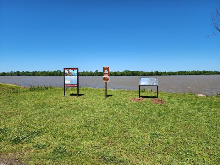
Maumelle Campground is part of the Arkansas River - Murray Lock and Dam recreation area. It offers 128 spacious campsites with electricity hookups and eight large group picnic shelters. Amenities mentioned include a dock, hot showers, a boat ramp, playground, basketball courts, electricity and water hookups, picnic tables, fire pits, grills, and dump stations. However, sewer hookups are not available, and users frequently express dissatisfaction with bathroom maintenance. The campground is set on the McClellan-Kerr Arkansas River Navigation System and features a scenic location along the river. Reviews frequently mention the clean and spacious campsites, although some criticize the lack of soap in bathrooms, short shower durations, and outdated facilities.
Researching this campground? Ask anything — other campers and our team will weigh in. No visit required.
Short heads-ups about the road in, gear quirks, timing, and more. You don't have to have been here to share what you know.
Rate Maumelle
Been here? Tap a star to start. Takes about a minute.
Sign-in required only if you want your name on it.

Pulled from per-site mentions in 996 reviews.
Site-specific reviews mention Site B32 as one of the best locations, offering riverfront views.
Site D02, however, is criticized for flooding and mud during rainy weather.
Be the first to review this campground
Every adventure creates another. Share what you learned so the next camper feels a little more prepared heading out.